
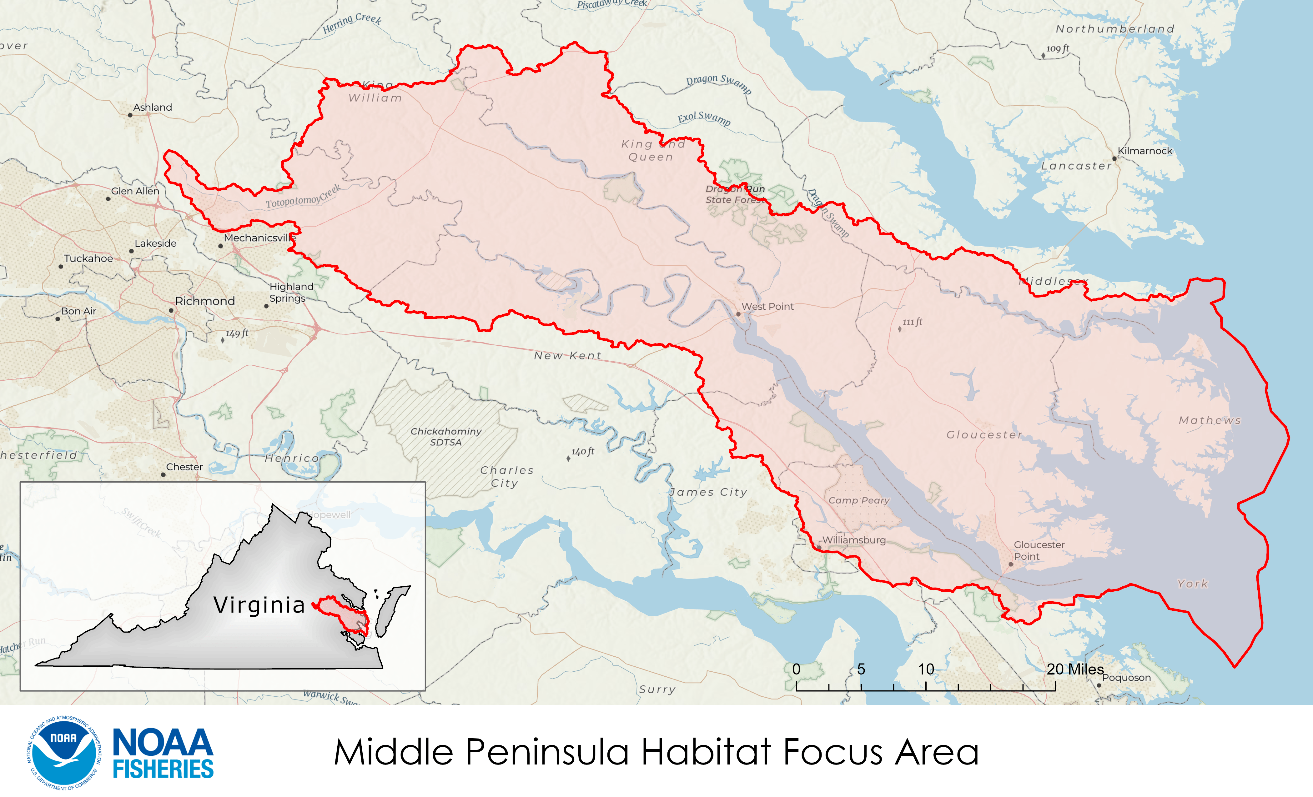
Middle Peninsula, Virginia
The Middle Peninsula of Virginia—surrounded by the tidal portions of the York River, the Piankatank River, and Mobjack Bay—is a landscape of scattered farms, forests, and small rural towns. It is known for its recreational opportunities, maritime industries, and indigenous and colonial-era history. The waters contain rich beds of submerged aquatic vegetation that support important commercial and recreational fisheries such as bluefish, summer flounder, and black sea bass, along with endangered Atlantic sturgeon. Oyster reefs, although substantially reduced from historic numbers, are being restored in rivers throughout the region. However, this rural area is experiencing significant impacts driven by climate change.
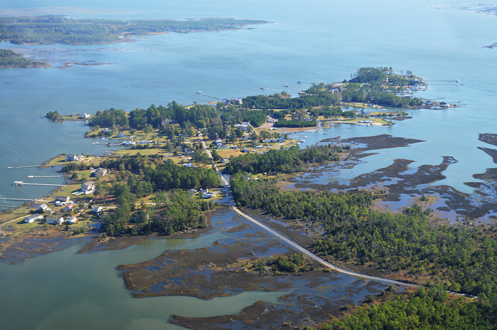
Residents of the Middle Peninsula live mostly near the shore, which is dotted with homes, marinas, and aquaculture businesses. The area’s remaining watermen earn their livelihood by fishing, crabbing, and harvesting oysters. The economy is largely based in maritime industries, agriculture, and silviculture (growing and harvesting trees). These industries contribute to the area’s significant amount of remaining open space—an oasis within the highly developed East Coast. Boating and other water-based recreation are cherished parts of life in the Middle Peninsula and contribute to the local economy. Nearby military bases, which provide jobs for local citizens, are also the site of several habitat restoration projects conducted in partnership with NOAA.
NOAA, other agencies and organizations, and communities in the area are working to bolster habitat conditions in the Middle Peninsula. Multiple federal, state, local and NGO groups are making collaborative investments to enhance habitat and coastal community resilience in the face of erosion, storm surge, and flooding. This is achieved through increased habitat restoration efforts, water quality improvements, and climate resilience projects. The region’s restoration community seeks to grow its capacity to develop targeted scientific and economic studies, enhance technical assistance on project development, and build a strong local network. Through the coordinated Middle Peninsula Habitat Focus Area effort, NOAA and its partners can enhance fish and shellfish productivity, support more resilient coastal habitats, grow a stronger maritime and seafood economy, and support community engagement and capacity. In one effort, NOAA is a partner in the York River Roundtable, which developed a regionally specific Coastal Wetlands Plan to guide conservation and restoration of area wetlands.
Threats
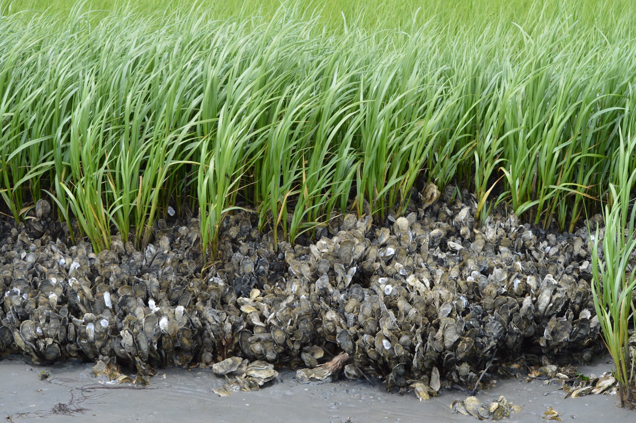
- The Chesapeake Bay, including the Middle Peninsula, has experienced a dramatic decline in oyster populations from colonial times. These populations are currently at 1 to 2 percent of historic levels. This decline is a result of disease, loss of habitat, and overharvesting. Healthy oyster reefs, valuable in their own right, also provide essential habitat for economically important fish species.
- The Middle Peninsula is experiencing high rates of shoreline erosion, flooding, and marsh loss as a result of increasingly intense coastal storms, sea level rise caused by climate change, and regional land subsidence. These events damage fish habitat and crops, threaten homes, and decrease property value.
Objectives
The vision for the Middle Peninsula Habitat Focus Area is a restored habitat that supports environmentally and economically sustainable coastal communities. To that end, NOAA and partners have three long-term goals:
- Enhance fish and shellfish productivity
- Restore resilient shorelines
- Build local capacity for restoration
Near-term objectives include:
- Restoring sub-tidal and shoreline oyster reefs in the York and Piankatank Rivers, and Mobjack Bay to enhance fish habitat for commercially and recreationally important species
- Supporting the design, implementation, and monitoring of wetlands restoration and living shoreline projects to reduce shoreline erosion, provide healthy habitat, and improve coastal resiliency
- Collaborating with local partners to develop a State of the York report, which will promote a shared understanding of ecosystem status and trends and enhance capacity
Collaboration
In the Middle Peninsula Habitat Focus Area, NOAA plans to work with other agencies, public and private organizations, research and science institutions, and local communities. These include the following:
- Department of Defense, U.S. Navy, U.S. Army Corps of Engineers, U.S. Fish & Wildlife Service, Commonwealth of Virginia (multiple agencies including the Virginia Coastal Zone Management Program), tribal governments, Virginia Institute of Marine Science (including the Chesapeake Bay National Estuarine Research Reserve Virginia), and local government planning commissions
- The Chesapeake Bay Program’s partners who support fisheries, habitat, and environmental education
- Local conservation organizations including National Fish & Wildlife Foundation, The Nature Conservancy, and York River and Small Coastal Basin Roundtable