
Magnolia Springs, AL
NOAA’s Magnolia River Living Shoreline Project
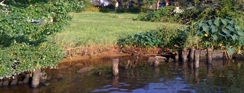
Erosion Issue: Significant erosion and shoreline loss caused by boat wake was creating problems at the Town of Magnolia Springs’ public access area. The site had several other issues, including residential stormwater discharges, a deteriorating dock, and bulkheaded shorelines on adjacent properties.
Project Technique and Background: The Weeks Bay National Estuarine Research Reserve, a key NOAA partner, provided technical assistance to town officials in vegetation planting, grant writing, and project implementation. In 2011, a low-profile breakwater was placed about 25-feet into the river, beyond the existing shoreline. The structure included gaps to allow for water exchange and sand was placed behind the breakwater to stabilize the bank. Invasive species were removed from the site and native, emergent wetland plants (including pickerel weed, wax myrtle, yaupon, and bald cypress) were planted within the sand-fill to stabilize the shoreline.
Project Completed: 2012
Habitat Value(s): The breakwater and new freshwater marsh provide protected shelter areas for fish and birds.
Site Resiliency: The vegetation and site remain stable, even after extreme rainfall events in spring 2014 that flooded the project site and caused saltwater intrusion.
Partners: Town of Magnolia Springs, Weeks Bay National Estuarine Research Reserve, Baldwin County Soil and Water Conservation District, U.S. Army Corps of Engineers, and U.S. Fish and Wildlife Service
Before & After: Slide the bar to the left and reveal the change. Color changes are seasonal.