
Coxsackie, NY
NOAA’s Coxsackie State Boat Launch Living Shoreline Project
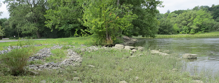
Erosion Issue: The site was built on a highly erodible, historic fill on the Hudson River. State and village officials were concerned that increases in shoreline erosion were about to impact the Coxsackie boat launch site and parking lot.
Project Technique and Background: The Hudson River National Estuarine Research Reserve, a key NOAA partner, provided technical assistance and support to the New York State Office of Parks, Recreation and Historic Preservation through its Sustainable Shorelines initiative, a NOAA-funded collaborative research project. In February 2012, shoreline restoration activities began by re-grading the shore zone to a shallow slope (less than 18 degrees) with clean fill; created three terraces of medium sized stone planted with native bulrush, pickerelweed, dogwood and button bush; and placement of small boulders in the intertidal as a partial sill to reduce wave energy and ice impacts to the shoreline. Sycamore trees were planted in the upland adjacent to the parking lot.
Habitat Value(s): The project enhanced freshwater, emergent, fringing marsh.
Site Resiliency: The gradual slope, rock, and plant features prevent further shoreline erosion adjacent to the boat launch and parking lot, while allowing continued visitor access to the river. The pickerel weed and bulrush showed significant growth, providing diversity in shoreline vegetation.
Partners: New York State Office of Parks, Recreation and Historic Preservation, Hudson River National Estuarine Research Reserve, Greenway Conservancy for the Hudson River Valley and students from Coxsackie-Athens High School.
Before & After: Slide the bar to the left and reveal the change.