Monitoring Island Health in the Chesapeake Bay
A team uses technology to track the effects of climate change on the Goodwin Islands, located in the Middle Peninsula Habitat Focus Area.
![Lush underwater grasses in the foreground with a small grassy shoreline at the rear](https://www.habitatblueprint.noaa.gov/wp-content/uploads/2023/08/563x750-GoodwinIslandsSAVFlowCreditOCM-1-225x300.jpg)
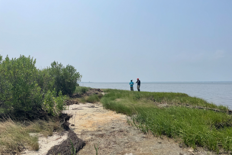
The Goodwin Islands are a collection of primarily salt marsh islands surrounded by intertidal flats and extensive beds of submerged aquatic vegetation. They are located on the south side of Virginia’s York River, where it meets the Chesapeake Bay. They are part of NOAA’s Middle Peninsula Habitat Focus Area. Habitat Focus Areas are places where NOAA addresses a high-priority habitat issue by working with partners and communities.
In the Goodwin Islands, climate change threatens habitat and the species that depend on it. Waves caused by intense storms chip away at the shoreline, especially on the islands’ more exposed east and south shorelines. Rising waters bring saltwater intrusion that affects plant life. These changes can mean that areas that were formerly upland forests become marshes, and former marshy areas become open water.
The Goodwin Islands are owned by the College of William and Mary. They are part of the Chesapeake Bay National Estuarine Research Reserve in Virginia, which is in the National Estuarine Research Reserve System. Several of our partners in the Middle Peninsula Habitat Focus Area play important roles at the Reserve. The Virginia Institute of Marine Science manages the Reserve. NOAA’s Office for Coastal Management provides funding, guidance, and technical assistance.
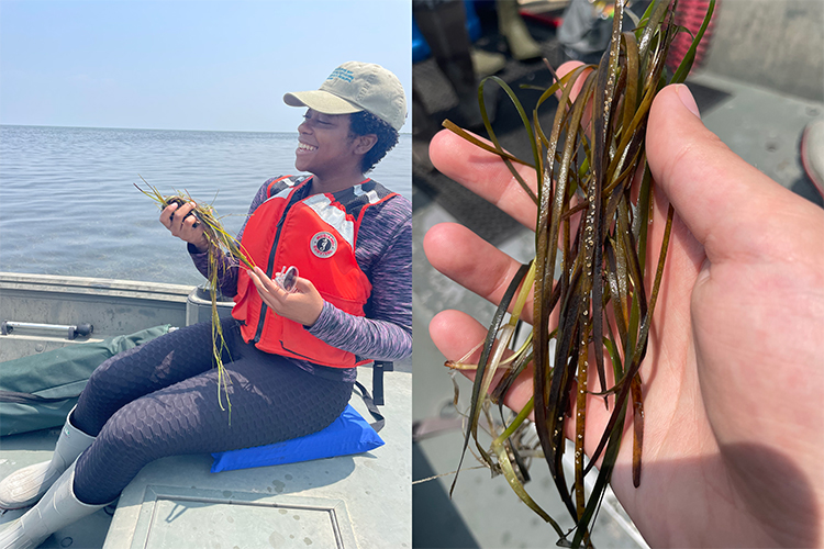
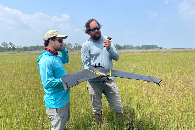
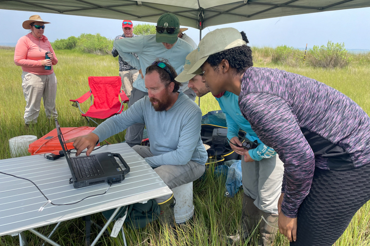
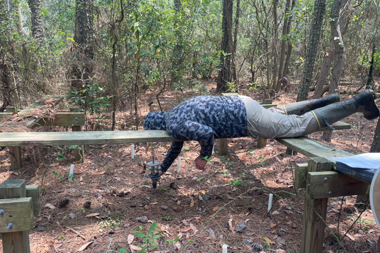
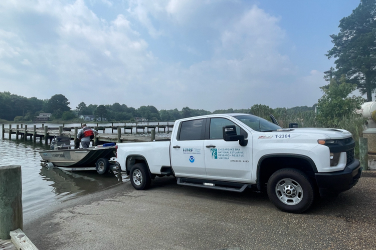
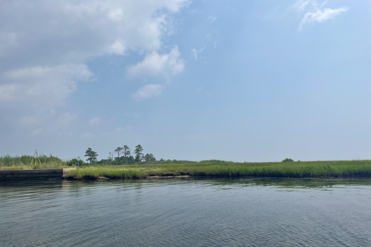
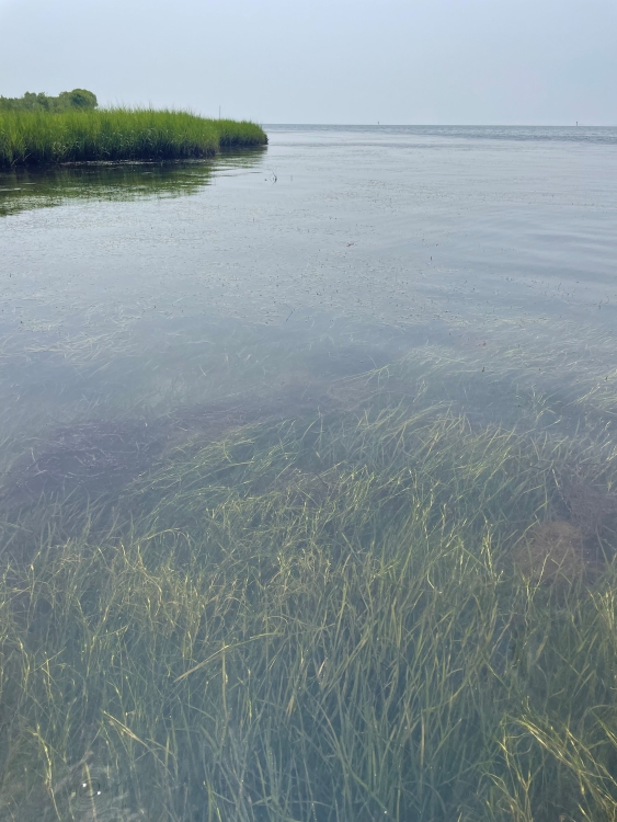
At the Goodwin Islands, scientists study how submerged aquatic vegetation and coastal marshes respond to environmental change. A recent visit to Goodwin Islands, captured in these photos, highlights the beauty of the area and showcases some of the science happening in the Reserve.
![Left: A woman, wearing a khaki baseball cap, orange lifejacket, striped purple shirt, and tall white fishing boots leans sits in a small boat. She is leaning against the side of the boat and smiles as she holds and looks at a clump of underwater grass. Right: A hand holds a small clump of green underwater grasses. A few worm tubes are attached to several strands of grass.](https://www.habitatblueprint.noaa.gov/wp-content/uploads/2023/08/750x500-GoodwinIslandsSAVfieldworkCreditOCM.jpg)
![Two people stand on a shoreline. There is marshy shoreline, a sandy area, and salt scrub bushes are visible.](https://www.habitatblueprint.noaa.gov/wp-content/uploads/2023/08/750x500-GoodwinIslandsDifferentHabitatsCreditOCM.jpeg)
![Two men stand in a marshy area. The man on the left is wearing a long-sleeved turquoise shirt and a tan baseball cap. The man on the right has on a long-sleeved light grey shirt. He is holding a large fixed-wing drone that looks like a miniature stealth airplane rather than the usual "quadcopter" drone](https://www.habitatblueprint.noaa.gov/wp-content/uploads/2023/08/750x500-GoodwinIslandsLaunchDroneCreditOCM.jpeg)
![Several people huddle around a laptop computer that is open on a folding while out in the field. They are protected from the sun by a pop-up tent.](https://www.habitatblueprint.noaa.gov/wp-content/uploads/2023/08/750x500-GoodwinIslandsDroneDataCreditOCM.jpeg)
![A man wearing a grey camouflage hoodie lays prone on a board several feet above the ground. With his right hand, he reaches to work with scientific equipment that is set in the ground.](https://www.habitatblueprint.noaa.gov/wp-content/uploads/2023/08/750x500-GoodwinIslandsMarshElevationCreditOCM.jpeg)
![A white pickup truck backs a small boat into the water at a boat ramp. On the truck are logos from several organizations: The Virginia Institute of Marine Science, Chesapeake Bay National Estuarine Research Reserve Virginia, and NOAA.](https://www.habitatblueprint.noaa.gov/wp-content/uploads/2023/08/750x500-GoodwinIslandsReserveTruckCreditOCM.jpeg)