Building Healthy Habitat and Empowering Coastal Communities in Rural Virginia
In Virginia’s Middle Peninsula, NOAA is coordinating efforts across the agency and beyond to support habitat restoration, improve coastal resiliency, and provide science and tools to regional decision makers.
In May 2022, a variety of exciting projects kicked off in the Middle Peninsula Habitat Focus Area, building on decades of partnerships and research in the region. On-the-ground habitat creation efforts, such as living shorelines and wetland and oyster reef restoration are being planned, or are well underway. To serve local communities better, NOAA is also working closely with partners and leveraging expertise across four of our offices to develop products, including online maps and a cornerstone report. These products integrate the latest science and research to help local planners and other stakeholders make informed decisions on sustainable management of coastal resources.
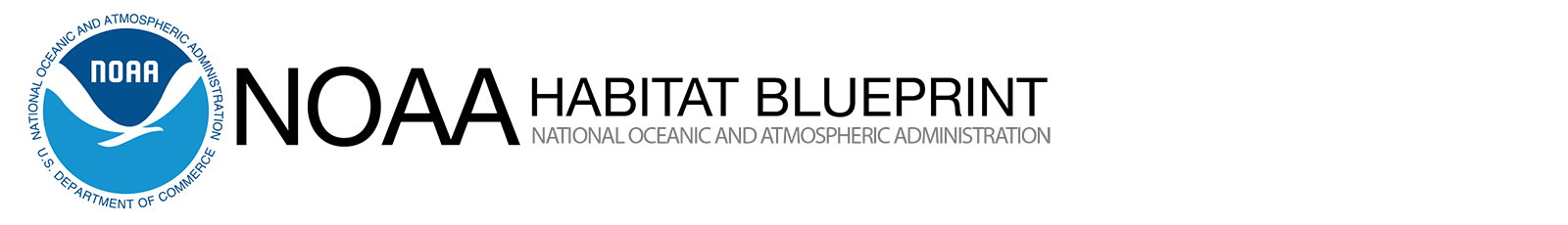
The Middle Peninsula
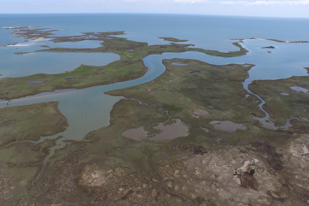
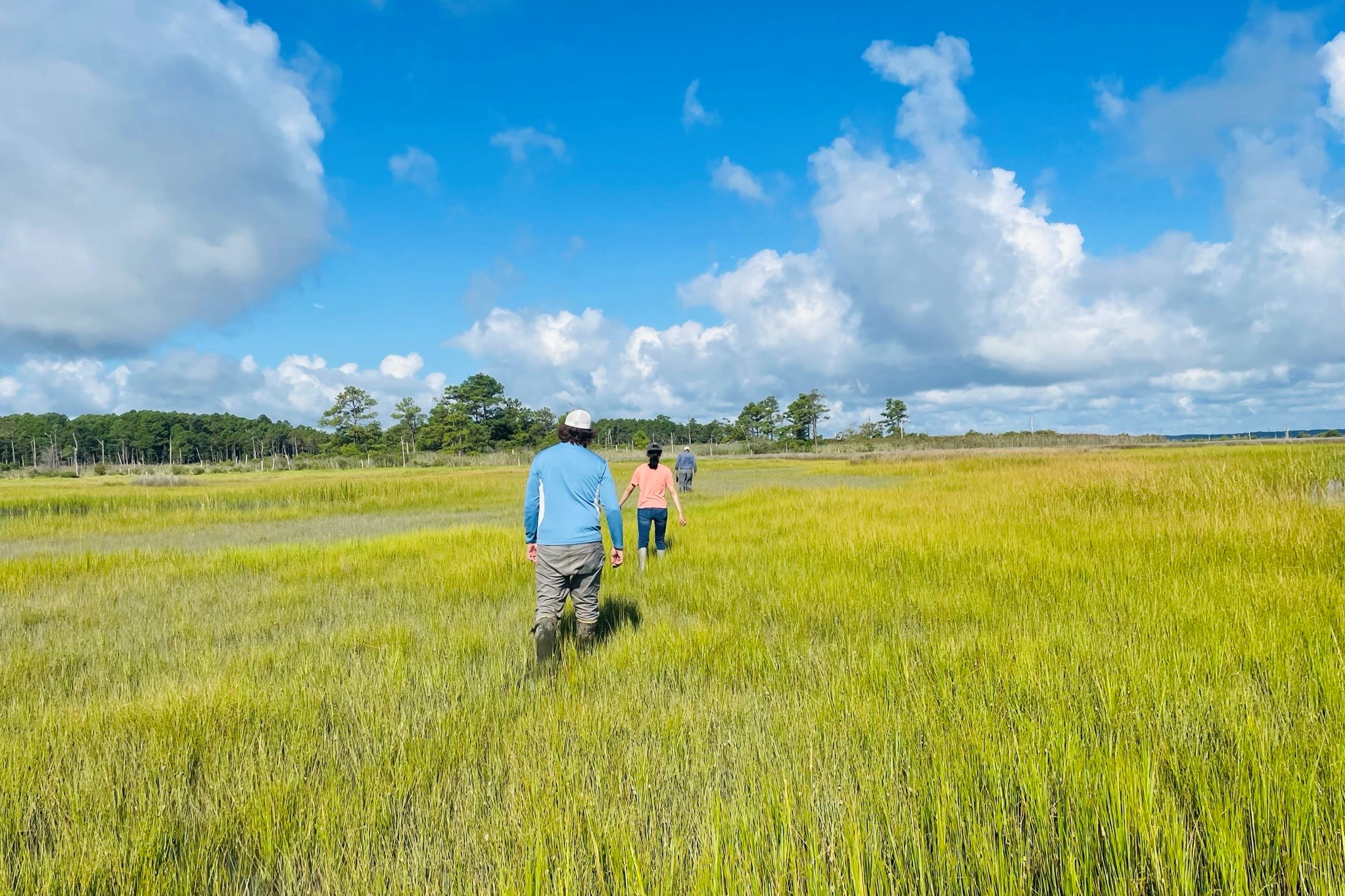
The Middle Peninsula of Virginia is a vibrant coastal area with a multitude of recreational opportunities, a rich history, and diverse habitats such as oyster reefs, seagrass beds, and tidal wetlands. These habitats support the endangered Atlantic sturgeon and important commercial and recreational fisheries such as summer flounder, black sea bass, speckled trout, and oysters, among many other marine species. However, this region is experiencing significant effects of climate change, which are stressing its communities and surrounding environment.
In response, NOAA selected this portion of the Chesapeake Bay watershed as a Habitat Focus Area. Habitat Focus Areas bring together federal, state, local, tribal, and non-government organizations to make collaborative investments that enhance habitat and coastal community resilience. By creating a common agenda, Habitat Focus Areas attract additional investment, catalyze new projects, build the capacity necessary for long-term stewardship, and forge partnerships that are key to creating lasting change.
Collaborating Within and Beyond NOAA
Habitat Focus Areas foster a collaborative approach to conservation within NOAA, leveraging expertise and other resources across our offices. Work in the Middle Peninsula brings together the NOAA Chesapeake Bay Office and Habitat Protection Division of NOAA Fisheries’ Office Habitat Conservation, the NOAA National Ocean Service’s Office for Coastal Management and National Centers for Coastal Ocean Science, and NOAA Satellites’ Center for Satellite Applications and Research. Together, these offices play a large role in strengthening existing local partnerships and building new ones. In turn, this enables Habitat Focus Area partners to serve local communities by identifying and addressing their needs.
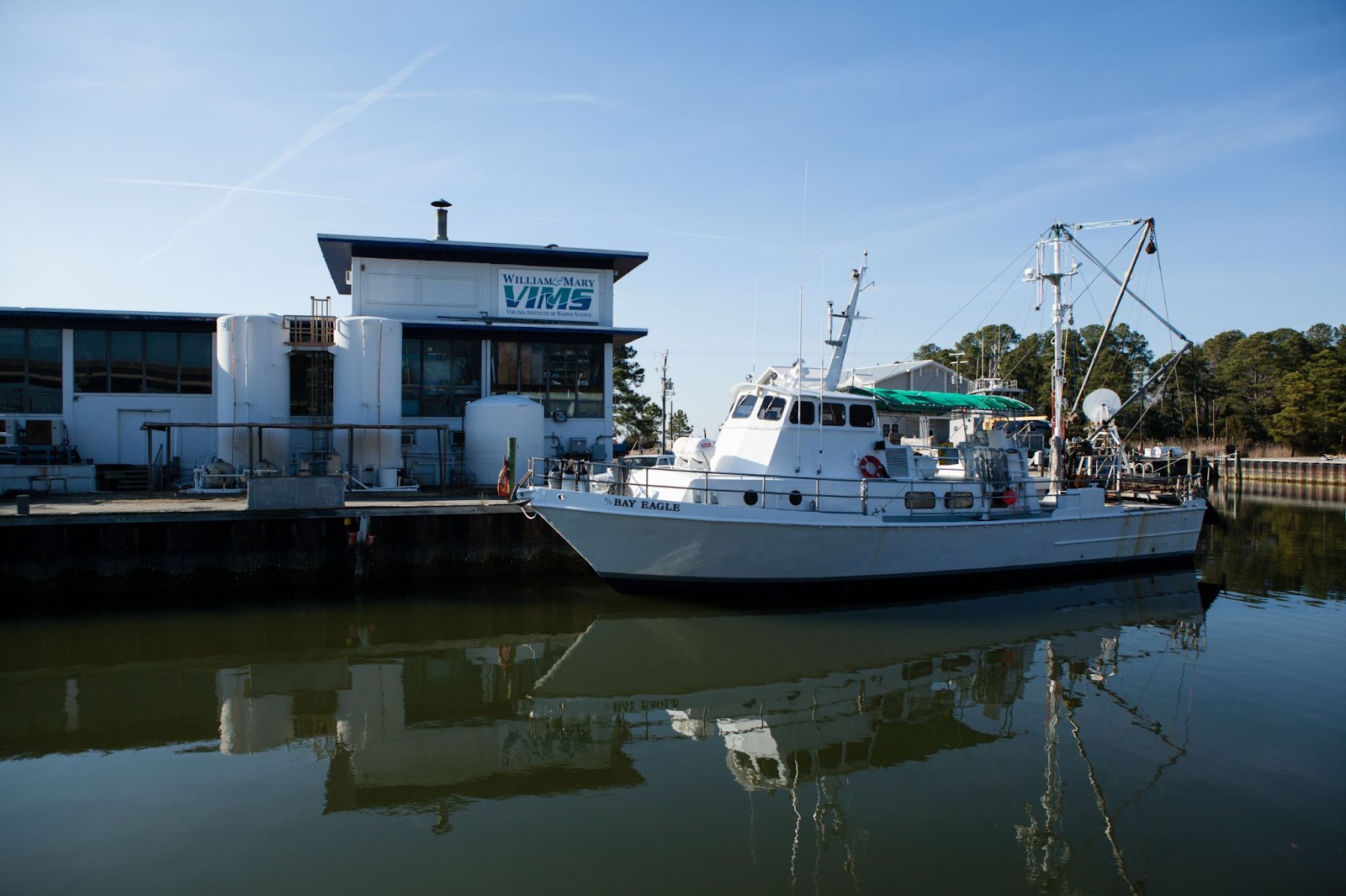
In the Chesapeake Bay region, many of these partnerships are long-standing and deeply intertwined. Notably, NOAA’s Office for Coastal Management provides sustained funding and guidance for the Chesapeake Bay National Estuarine Research Reserve in Virginia, part of a national network of partnerships between NOAA and coastal states to study and conserve estuarine systems. The reserve, administered by the Virginia Institute of Marine Science, supports the day-to-day activities of the York River and Small Coastal Basin Roundtable. The Roundtable serves as a forum for information sharing and collaboration for stakeholders in conservation, with a focus on water quality.
Serving Communities
Among its many initiatives, the Chesapeake Bay National Estuarine Research Reserve in Virginia received funding from the National Estuarine Research Reserve Science Collaborative to support the Roundtable in developing the next State of the York Report. The report will provide an up-to-date, comprehensive, and accessible look at the health and resilience of the York River watershed—the largest watershed in the Middle Peninsula—and outline steps to improve it. It has been more than 20 years since the first report was published, and gaining access to updated information is a major priority for local stakeholders. The report will inform decision making and improve communities’ understanding of issues that affect the health of the river and its tributaries.
In addition, NOAA’s National Centers for Coastal Ocean Science is partnering with the reserve to better understand human uses of York River natural resources. They plan to create an index with newly gathered data. The index would help planners understand where to focus resources to improve the quality of recreational opportunities—such as boating and fishing—and access to recreational areas.
Sharing Information
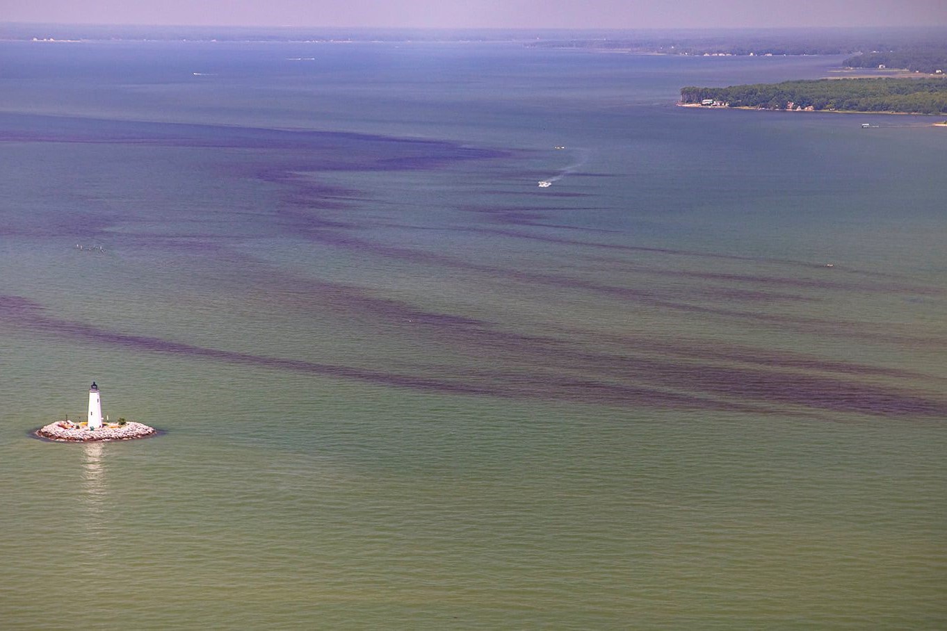
To plan and build communities more resilient to climate change in the Middle Peninsula, decision makers need a wealth of scientific information. In particular, satellite data is incredibly valuable, filling gaps when on-the-ground measurements are impractical, or impossible. However, turning raw satellite data into useful information can be challenging work that requires specific expertise. NOAA’s Center for Satellite Applications and Research is working collaboratively with stakeholders to develop high-priority products. A web-based portal will allow users, including the Middle Peninsula Planning District Commission and the Virginia Institute of Marine Science’s Center for Coastal Resources Management, to evaluate these products in context—alongside existing data and common socio-economic GIS layers like municipal boundaries and population density. These products will show:
- Areas prone to flooding
- Bathymetric maps to inform dredging projects
- Hotspots of shoreline accretion, erosion and coastal eutrophication—or excessive nutrients
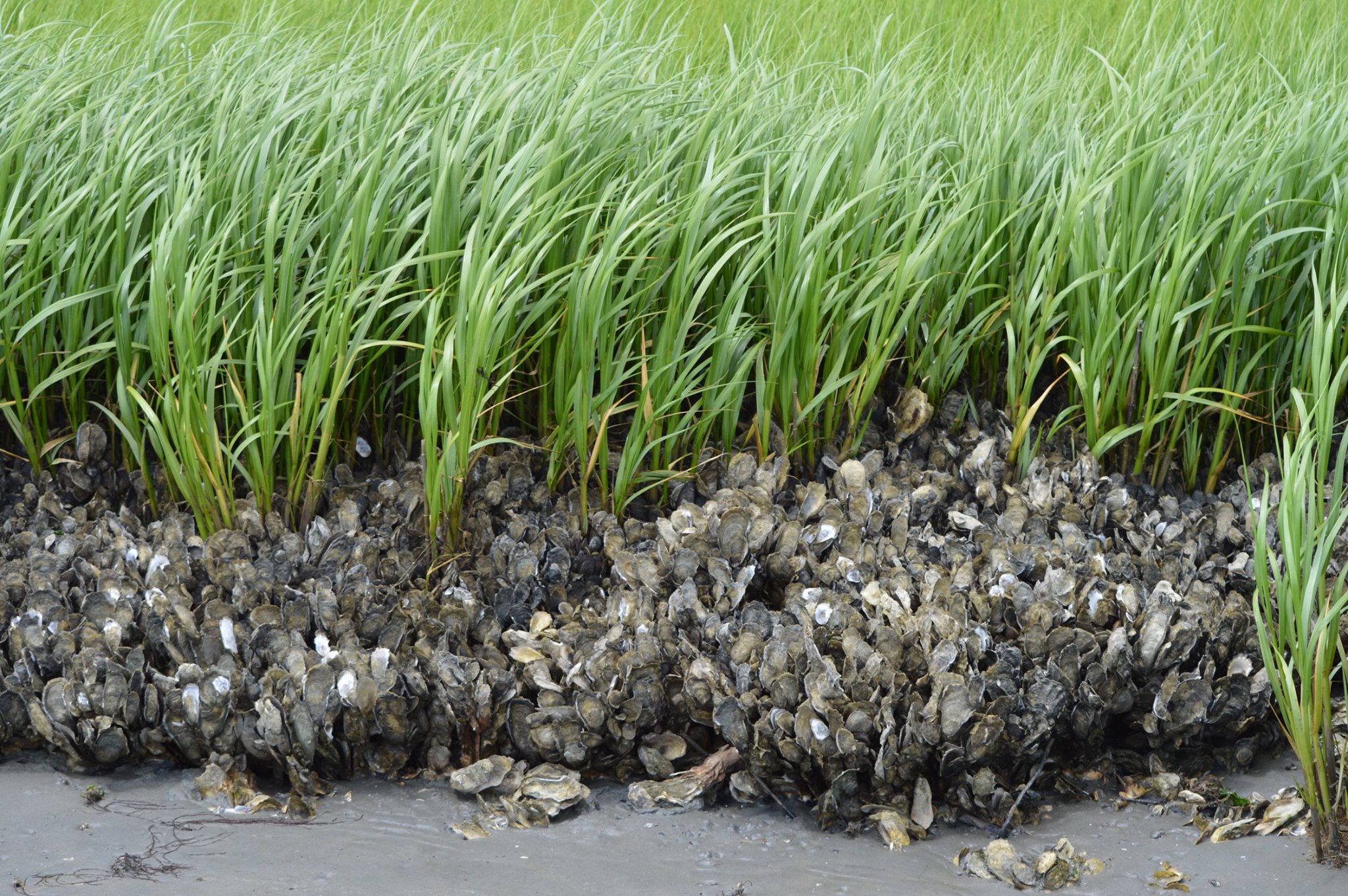
- Suitable locations for seagrass beds, an important habitat that supports a diversity of marine life.
Additionally, NOAA’s National Centers for Coastal Ocean Science is using satellite imagery to monitor harmful algal blooms in the watershed. While generally not a direct threat to human health in the Chesapeake Bay region, these blooms can kill fish and shellfish, impacting both aquaculture and wild stocks of these animals.
Looking to the Future
As more work in the region unfolds, we look forward to sharing updates on exciting milestones and accomplishments, and how communities and habitats are benefitting from these synergistic efforts.
More Information
- NOAA Fisheries Office of Habitat Conservation
- NOAA Habitat Blueprint: Middle Peninsula, Virginia
- NOAA’s Office for Coastal Management
- NOAA’s National Centers for Coastal Ocean Science
- NOAA Satellites’ Center for Satellite Applications and Research
- Chesapeake Bay National Estuarine Research Reserve in Virginia