
Efforts to Restore Native Wild Rice in the St. Louis River Estuary
In the St. Louis River Estuary Habitat Focus Area, NOAA and our partners are working to preserve and restore wild rice through habitat mapping, ecosystem service studies, and education and outreach efforts.
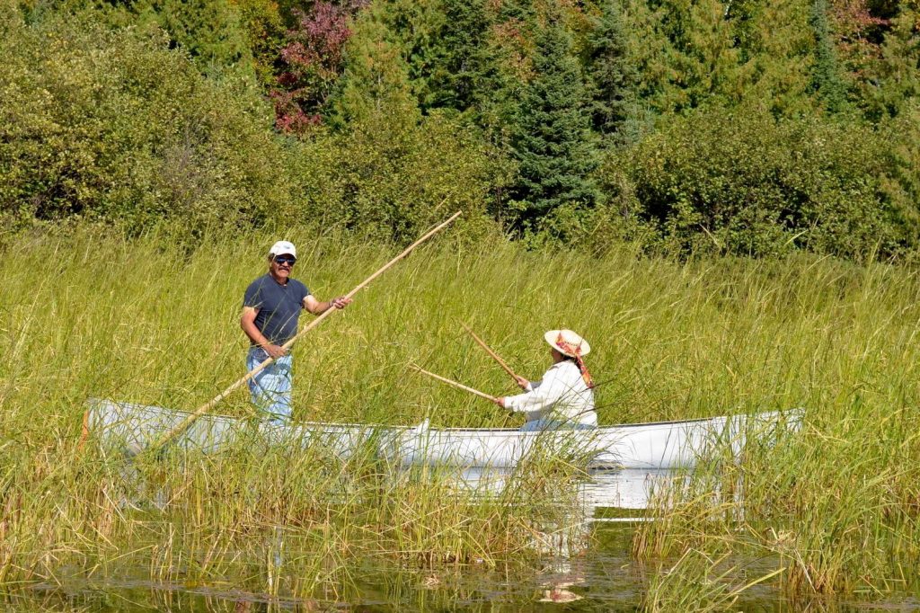
Northern wild rice is an ecologically and culturally important part of the Great Lakes landscape. It serves as a food source and breeding habitat for a variety of fish and wildlife species. It also helps to maintain water quality by storing sediments and absorbing excess nutrients. Known as manoomin in the Ojibwe language, it is a sacred symbol for the Ojibwe people. It represents their relationship to the land, and is a dietary staple that provides spiritual and cultural sustenance.
Wild rice was once abundant in the St. Louis River estuary, but has been reduced to a few remnant stands over the last 50 to 100 years. It has been affected by many environmental stressors, including variable water levels, degraded water quality, and predation by wildlife. These changes have disrupted tribal harvests for wild rice and native wetland species around Lake Superior and its tributaries.
While previous restoration efforts have improved water quality in the estuary, wild rice populations did not rebound on their own. Wild rice bed restoration was identified as a key habitat improvement that would help move toward delisting the St. Louis River estuary as an Area of Concern by the U.S. Environmental Protection Agency.
Identifying Project Areas for Wild Rice Restoration
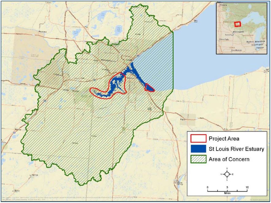
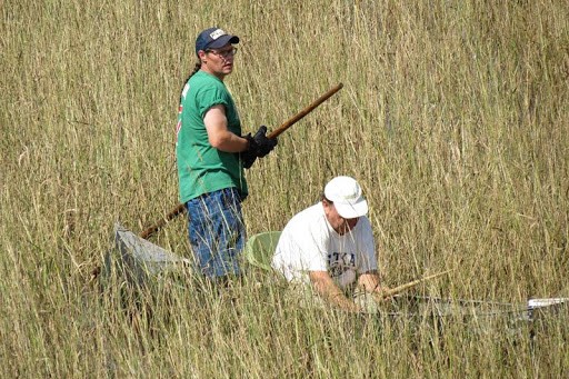
In 2014, NOAA and partners kicked off the process by identifying primary areas for wild rice restoration efforts in the St. Louis River estuary. They ranged from the Fond du Lac Dam downstream to Grassy Point in Minnesota, and Allouez Bay in Wisconsin. These areas include sites where wild rice historically grew and offered the best opportunities for successful wild rice restoration. However, partners lacked detailed mapping or survey data on the location and extent of wild rice beds. With funding from the Great Lakes Restoration Initiative, NOAA supported a collaborative project among tribes and partners to digitally map wild rice locations and foster the cultivation of Lake Superior wild rice. These efforts would help to preserve the cultural legacy of Native Americans in the region.
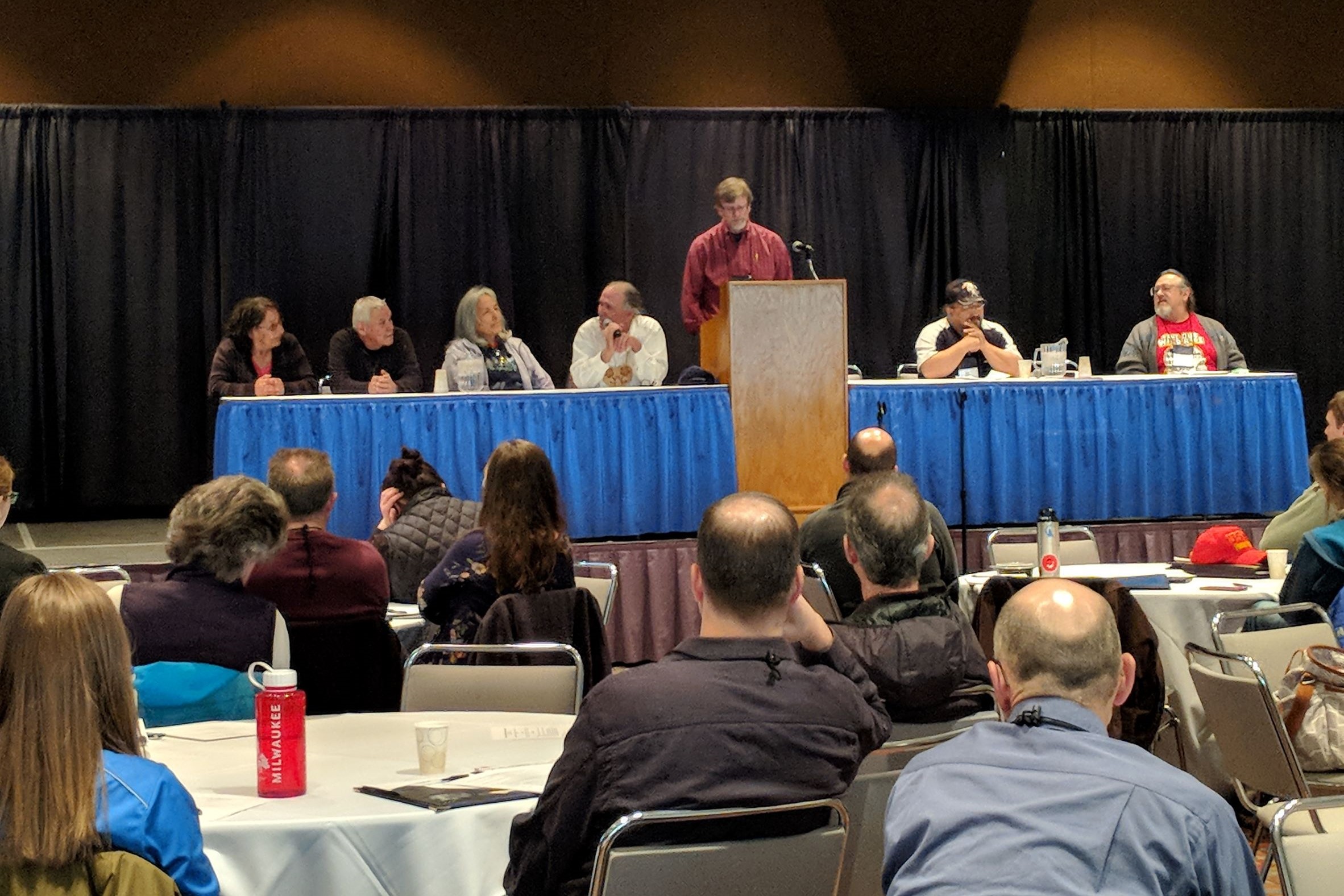
From 2017 to 2019, NOAA’s Office for Coastal Management hosted multiple workshops to further identify priorities and challenges surrounding wild rice restoration and monitoring efforts. More than 70 participants from Lake Superior tribal communities and agencies, and federal, state, and local partners attended the workshops. Through participatory mapping exercises, partners combined tribal knowledge of wild rice locations with land cover data from NOAA’s Digital Coast. They pinpointed where to focus data collection and monitoring. Participants selected three study areas within the St. Louis River estuary and watershed and three others in the Lake Superior basin. They also identified three projects that would help to protect and restore wild rice while increasing cultural knowledge and awareness about the species. The projects are:
- Creating maps of potential restoration sites
- Defining the value of ecosystem services provided by wild rice
- Developing new education and outreach partnerships with NOAA Sea Grant programs
Mapping Potential Restoration Sites
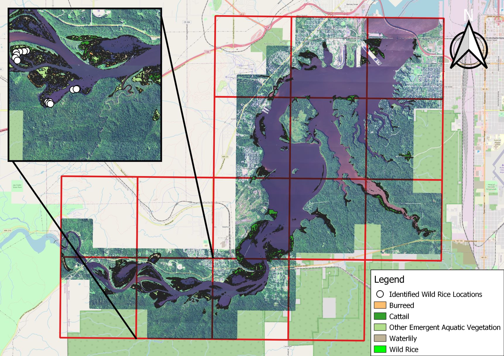
NOAA’s Office for Coastal Management conducted hyperspectral mapping—an imaging technique that analyzes the light spectrum—of the primary study area to identify areas that may be suitable for restoration. The resulting maps allowed the team to better understand the spatial extent and habitat suitability of wild rice based on the presence or absence of other wetland species. Analysis of the mapping imagery confirmed a significant decrease in the spatial extent of wild rice. It was present at only 15 locations, totaling less than 0.2 acres within the St. Louis River estuary. This was a sharp decline from the nearly 1,000 acres observed in the 1960s.
The project also informed management decisions such as how to address predation by wildlife, particularly that of Canada geese, to achieve successful restoration. Other researchers have also used the publicly available imagery to better understand the estuary, including mapping aquatic and wetland communities, to inform restoration efforts.
Valuing Ecosystem Services of Wild Rice
NOAA wanted to understand the ecological and cultural importance of wild rice. We supported a valuation study on its ecosystem services (PDF, 101 pages) and the coastal wetlands in which the plant is found. The study demonstrates the importance of wild rice for resource managers and decision makers, and highlights the need to foster community stewardship and education. These insights provide an opportunity to connect the ecosystem services valuation study to future policy decisions. It will ensure they are aimed at best serving the interests of the Ojibwe people and protecting and restoring coastal wetlands in which manoomin grows.
Collaborative Education and Outreach
To raise awareness of the cultural and ecological importance of restoring wild rice populations, NOAA and partners in the region designed an education and outreach toolkit. It integrated traditional knowledge with Western science. To support the collaborative effort, NOAA provided $30,000 in funding to the Michigan, Minnesota, and Wisconsin Sea Grant programs in 2018. The programs matched this funding with $15,000 in non-federal funds. Learn more about the importance of outreach and education around this coastal wetland species in the University of Wisconsin Sea Grant Program’s Wisconsin Water News podcast.
Partnering for the Future of Wild Rice
Important scientific and socioeconomic information collected to date will support future restoration of wild rice within the St. Louis River estuary. NOAA and partners will continue to advance this restoration priority with support from the Great Lakes Restoration Initiative as outlined in their latest action plan (PDF, 30 pages). With more than $400,000 in funding from the initiative, NOAA and the Bureau of Indian Affairs will carry out on-the-ground restoration of coastal wetlands in the estuary. This work will include seeding, vegetation management, protection from Canada geese and common carp, and monitoring the success of restoration areas to help inform future projects.
Additional partners contributing to the above efforts to restore wild rice in the St. Louis River estuary include: