WHHFA Benthic Mapping Figure 1.
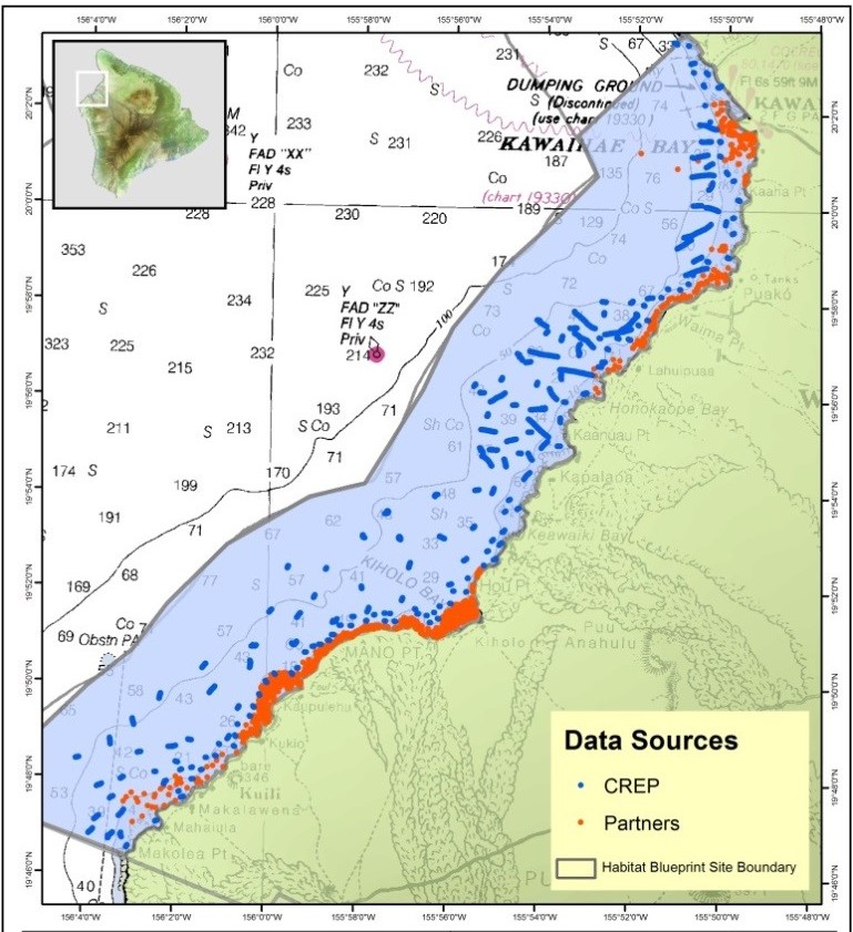
Boundaries of the WHHFA and location of the project’s optical surveys. Surveys in red were collected by the contributing data providers, and surveys in blue were collected by CREP scientists.

Boundaries of the WHHFA and location of the project’s optical surveys. Surveys in red were collected by the contributing data providers, and surveys in blue were collected by CREP scientists.